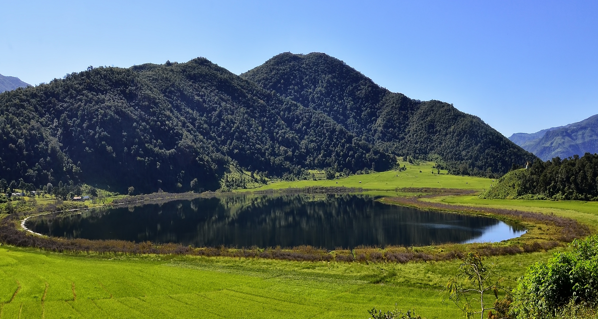
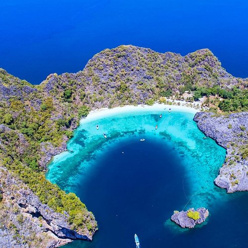
Welcome to Mythical Heart-Shaped Lake(Rih Lake)
Explore the Diversity of States and Regions
In Burma


Chin State
Chin State is one of the mountainous regions in Myanmar. It is 36,019 square kilometers and is bordered by Sagaing Region and Magway Region to the east, Rakhine State to the South, Bangladesh to the South-West, and the Indian States of Mizoram to the West and Manipur to the North. “In Chin state, you can find a heart-shaped lake between the mountains called Rih Lake. It looks Heart shaped when we look at it from the top of the mountain”. The lake is surrounded by willow trees and has an interesting history too.
Mythical Heart-Shaped Lake(Rih Lake)
The Rih lake is situated at Rih Khaw Dar town,Falam district in northern Chin State, and is 2,800 feet above sea level. Rihkhawdar is a small town, a border town of India and Myanmar, and is 46 miles away from Falam township.
Mizo ethnics mostly live in Rih Khaw Dar. It takes only 15 minutes to reach Rih lake from the town. Mizo (Lushei, Pawi, Ralte, Hmar, and Paihte are the 5 major tribes in Mizo), Burmese, Indian, and other Chin Ethnic people mostly live in Rihkhawdar town. There is a bridge that passes the Tio river, the border of the two countries (Myanmar and India). Tourists can come to Myanmar across that bridge also known as Indo-Myanmar Border Gate. There are two main roads to get to Rihkhawdar. The first one is from Falam township and the second one is from Tedim township.
This pristine heart-shaped lake has a huge meaning for the Mizo who live on both sides of the border. The lake is a major pilgrimage site for the Mizo not only in Chin State but also in the Mizoram State of India; additionally, it is also a most-liked place to hang out for people who live nearby, they come to swim, drink or have fun at weekends. On weekends, the lake is considerably more tranquil and peaceful, making it an excellent place to unwind, get in touch with nature, and flee from the commotion of cities in Myanmar.